Wednesday, September 30, 2015

Southwest Coast of Nova Scotia

 We left Halifax after an almost teary goodbye with Mark, Jen and the kids.  It was so great being a part of their lives the past year. To have seen the boys grow and mature over the year, to do kookie things with my daughter and all the help Mark has given us from trouble shooting our motor, to accepting all our various boat parts that come by mail, and finding us one of the nicest cars we have owned, it was very difficult for me to leave. 
We have had some superb weather, wind from behind for the most part and beautiful bright sunny days with cooler nights.  There was a frost warning two nights ago so I am hoping some of the leaves will turn before we leave the country.  I have cancelled my phone service as of Oct. 5 so if the weather continues to be kind to us we will cross to the U.S. just before it runs out. 
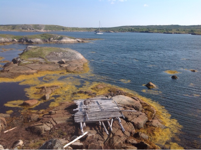
                          Looking out over the water.

Our first stop after Halifax was Chester, NS. There are quite a number of Americans that live here so it had a "Cape Cod" feel to it, with huge mansions lining the shorelines.  They have boat houses with enough square footage that we could comfortable live in.  We stopped to borrow some U.S. charts that a fellow in the Race the Cape said we could have.  While we were swinging on our anchor he came by in his motor yacht and offered us the use of one of his moorings. Meanwhile another fellow whom we had very briefly met stopped by to say hi and later on dropped off some home grown vegetables, carrots, potatoes, tomatoes, and some preserves,  WHAT A TREAT! 
          Something to add to my sign collection. 
Today we are in Lunenburg today and marvelled at the Bluenose II. It is absolutely beautiful but at $45 for a two hour ride we decided to forgo a chance to ride on the Canadian Icon. 

Today was maintenance Monday we were told and we got a chance to briefly chat with a couple of the crew.  I exchanged varnishing stories with one girl and another fellow said he had been aboard during the summers since 2004, what a great summer job.  He has finished his education and is planning to go lobster fishing once the Bluenose II is put to bed for the winter. 
                                     The colourful Lunenburg waterfront. 
That afternoon a former co-worker of Barry's came and picked us up and took us on a very picturesque tour around Lunenburg county. We ended up at their home, they have a lovely newish bungalow with 1.3 acres of property that borders on a small pond.  They have two Labrador dogs and we witnessed them plunging into the pond off their dock to get a floating bout, they loved it. We had a wonderful time as we were treated to a haddock dinner and introduced to a game of washers.  It has much the same rules as horseshoes but it is played with heavy metal washers and you have to get them in a wooden square container. Instead of a stake to get a ringer inside the square is a tube that they put around a lobster once they catch it to contain it's claws.  Too much fun, the girls triumphed in the game of girls against the boys but when the Langes took on the Strydes we were beaten badly!! 


Wednesday, September 23, 2015

Sydney to Halifax


We left Sydney with the promise of a NW wind of 30 knots in the forecast.  It came through like gangbusters and we rode that wind until it changed to the usual Southwesterly. In all we sailed 141 mm in 24 hours, almost a 6 knot average so we were just humming along.  Once the wind changed we picked a nearby anchorage and in we went.  We then had the luxury to dawdle along picking out lovely secluded anchorages as we slowly made our way towards Halifax. Today once again they promised a north wind so we left ourselves almost 50 miles to go downwind to arrive in time to meet up with Barry's sister Kim. They are arriving tomorrow on a much larger ship!!  We are within 10nm of marina we plan to stay at so all is good. 
The weather has been kind with sunny warm days and foggy evenings.  Our radar has been coming in very handy along this coast. We have not been ashore since we left Sydney, I was feeling a bit boat bound last night and I was going to go exploring in the dinghy but the fog rolled in and you could only see 100m. so there was really no point.  I have my list for the chanderly in Halifax ready and the to do list is shrinking daily!! 
We met Barry's sister Kim and her husband Brent today, they are on a cruise from Quebec City to Boston.  We had a lovely day, wandering along the waterfront and then strolling up the hill to the citadel to hear the noon gun. After a leisurely lunch we walked back towards the cruise ship, it was great to catch up with them again. 

IMPORTANT SAILING INFO.
We are using the "Cruising Guide to the Nova Scotia Coast" published by Alexander Weld, printed by Pilot Press in Chestnut Hill, Mass.

Ports or Anchorages

Gegogan  45*03.1' N X 61*57' W
Anchored in 5m off the NE shore of Rae Island
Very good holding in mud, good protection from all directions
No services

Ecum Secum Inlet  44* 57.4'N X 62*09.4' W
Anchored in 7m behind Hardwood Island.
Very good holding in mud, good protection from all directions
We did not go ashore, cell ph. service 

Sheet Harbour Passage  44* 51.2'N X 62*26.9' W
Anchored in 4m in behind Factory Point on Sober Island 
Very good holding in mud, good protection from all directions 
We did not go ashore, cell ph. service. 

Borgles Island   44* 57.4'N X 62*09.4' W
Anchored in 9m, limited swing room but adequate so judge carefully where you drop the hook. 
Very good holding in mud, good protection from all directions 
We anchored in Deep Cove, checked out anchorage on south side but too much swell in SW wind 
We wanted to go ashore but fog rolled in, cell phone service, no other services. 


Monday, September 14, 2015

Back in Sydney NS

We had a great time at the beach yesterday with Jennifer, William and Leeland. There were some waves so Jen and William surfed a bit.  I went in and boggie boarded for awhile as did Leeland. Grandpa supervised from the comfort of his beach chair.  We flew kites, built sand castles and had a great lunch.  What a lovely day, thanks for organizing it Jen.  
The day before we went out in Jen's new hobbie cat for a sail.  There wasn't a lot of wind but William came on the boat with me and got the basics of steering and using the main sheet down. Later his Mom took him out and demonstrated how to tip and upright the craft.  He had so much fun that he wanted to do it again and again and again. It was fun to watch him try and stay on the high side and then get flipped off as he went vertical in the air! 
We are busy getting boat chores done and we are about half way through my list.  It is raining today which will delay the hull polishing that I think we should do in order to maintain the lovely new paint job we got two years ago. We are going to leave for Halifax on Wed. Barry's sister Kim and her husband Brent will be there on a cruise on the 22 so we are planning to meet. Then Jen is having her eyes re lasered on the 24 and the boys will spend the night with us so she and Mark can get some rest. 

Thursday, September 10, 2015

Heading home down the south coast

                                      Leaving St. John's Harbour at dawn 

We are on our way back to Sydney, NS and are on a mission, no time for sight seeing. Leaving St. John's Harbour we sailed pass Cape Spear, the most easterly point in North America.  It was neat to sail past after standing there last year and wondering if we would ever be by this way again! The next day we sailed past Cape Race which is considered the bottom of the Avalon Penninsula and turned the corner to head west. We have had enough wind to sail most days but unfortunately it seems like it is always on our nose. That means we have to tack back and forth going about 1 and 1/2 times the distance we would need to if we went in a straight line. We have been sailing until we have about 10 miles to go and then getting tired, we turn on the motor and motor sail in a straighter line to our destination. 
                     Cape Spear the most easterly point in North America

When we left Trespassey we had an overnighter in order to reach a safe port which was not 20 miles out of our way.  The winds were once again on our nose and kept picking up all day.  By nightfall we were down to a double reefed main and the staysail. We were still making headway but the waves were over 3 meters and the boat was taking a pounding. We hove to,with just the main up and the tiller hard over and just slowly went backwards. After a couple of hours of this I put a little foresail up and started sailing again.  Barry was very unhappy and so was the main, it protested by letting go on a seam just above the second reef.  (The stitching on the main is very weak due to UV damage, we need to get it re stitched.) We reefed down again to the third reef and once again started to slowly go backwards. The wind abated about 0400 and we were sailing again.  At 0900 hours we had the full genoa, staysail and triple reefed main up and were making good time in the bright sunshine. At 1100 hours we were motoring to make landfall before dark and we took the main down and off of it's foot and started sewing.  
This morning, which is the next day we woke at 0330 and decided to motor 20 nm as the wind was on our nose, to the next anchorage to wait out a coming gale.  30 knots are predicted with gust to 40, YIKES but not until noon so we are counting on the accuracy of the forecast and making a run for it.   We decided to motor the distance because that would leave us with about 180nm to go to Sydney and there are NE and SE winds predicted for the days following the gale so we should have the wind behind us for a couple of days. Send us your best wishes for following seas!!


IMPORTANT SAILING INFO.
We are using " The Cruising Guide of Nfld." published by Members of the Cruising Club of America and it has been very "helpful.
Ports or Anchorages

Fermeuse Harbour  46*58' N X 52*56' W
Tied to the dock at the harbour west of Sheep's Head.
Electricity and garbage disposal available at dock, no water, no charge, came in late, left early. 
No info. on services in town. 
Great protection lots of water going into the dock. 

Trespassey  46*44' N X 53*22' W
Anchored in 5m. of water in NW arm. Put out 50 m. of chain. Good holding
Picked up a log on the anchor. 
Dock available but very open to W and SW winds 
No info. on services easy entrance into harbour. 

Little St. Lawrence  46*55' N X 55*21' W
Anchored in 4m. of water. Good holding, Hurricane hole, great protection all around. 
Services available in town I km. away by road. 
Very friendly locals. 

Lamaline   46*51.4' N  X 55*48.3' W
Tied up at the wharf. Very protected dock.
Follow the buoys and watch your charts going in, we saw 2.8 m on the depth finder at low tide. 
There is a floating dock with adequate water to tie up. 
Water, tap on building to left of pier, electricity, garbage disposal available, no charge
Fuel, groceries available about 1km. away, 2 offers of rides 
Walking trails on Allan Island with views of St. Pierre, great stop. 

Wednesday, September 02, 2015

St. John's

B
We are tied up to a floating dock right in downtown St. John's. When we came in there was an Australian boat tied up to the dock and as soon as our boat was secured we were swapping stories. They left Australia in 2003 and have been in many of the same places as we have and we have mutual friends.  What a pleasure it was to connect with them. 
We have been enjoying St. John's, wandering around looking in shop windows, I got a little retail therapy and bought gifts for new grand nieces and nephews and sent off a present to Australia.  I hope it gets there before Christmas because I sent it surface mail, I figure whenever it gets there the kids will be happy. The style of architecture here is unique and quite enjoyable. 


There is lots of history in St. John's and the city has done a great job with a number of historic walks in the downtown area.  At each stop there is an excellent map of where you are on the walk and a description of the relevant landmark.  We are located at Queen's Wharf just down from a war memorial, there is a picture of when it was unveiled back in the 1920's and the huge crowd that attended that event.  Right next to us is where the big ships that service the oil rigs dock.  We were a bit worried when we arrived that their comings and goings would batter the boat against the dock with their prop wash, but it has not happened, they are always facings us!
We went up to the Geo Centre yesterday, it is an excellent facility. Newfoundland has some very interesting geology and they have great displays, movies and interactive exhibits for children to do.  Included was a display on the Titanic and I got the inside dope on how and why messages from other boats telling of the icebergs where ignored, shocking!! 
We will be here for a total of 4 1/2 days, we are waiting for a predicted 30 knot northerly to blow itself out.  Barry originally wanted to move on before it arrived but I was more than happy to wait here where there are a huge variety of things to do. We are planning on taking in some local theatre tonight!!
Newfoundlanders seems to have a wonderful quirky sense of humour. 
I think the Sisters of Mercy would be turning over in their graves. 
Oh something I keep forgetting to tell you.  I saw some puffins, after icebergs that is the next thing I wanted to see here.  They are tiny birds which always seem to turn away from the boat all the time so they are really hard to get a good picture of. Then they either dive or use their wings to flap wildly away, almost taking off but not quite, just putting distance between them and the boat. The other thing we saw was a bunch of biggish fish leaping in and out of the water.  We think they were either tuna or mackerel by the shape of their bodies and tails.  We were sailing along in very light winds and I heard this perculiar noise and as I turned I saw them leaping about a meter into the air. It was awesome. 

IMPORTANT SAILING INFO.
We are using " The Cruising Guide of Nfld." published by Members of the Cruising Club of America and so it has been very helpful.
Ports or Anchorages
St. John's  If you don't where it is just look it up on any map!!
Tied up to a floating dock at Queen's Wharf, lots of gawkers, 2 tried to get on boat for pics. 
There is no water, electricity, showers or laundry.
Great access to the downtown area. Laundry 5 min walk. Bus stop 2 min. Good website for buses.
Showers at Max fitness centre on #3 bus, a little further on there is a Sobie's a large grocery store. 
Price, minimum one week stay $42
Possible to tie up at pier 6 & 7, noisy & busy, closer to George St. 

Monday, August 24, 2015

Down the East Coast of Newfoundland


                                                           Fogo Harbour

Newfoundland is mostly a province of fishing villages.  The towns are built higgily piggily along the rocks around natural harbours. We were told that the houses had to be built close to where the fish were because back in the day before there were engines, you sailed or rowed out to the fishing grounds.  Almost every cove we have seen there are houses.  Even in the abandoned outports some people still maintain their former houses as summer homes or as temporary shelter when they are out fishing.  Dwellings are perched atop the most unhabital looking rocks, on islands miles from shore.  
                                          Salvage, a truly picturesque spot. 

                   I love all the shades of red on these two story sheds in Salvage. 

Gear stacked in the fishing sheds. 
The other day we took a day off from sailing and stayed put in a wonderful little hurricane hole called Puddingbag Cove. That's another thing, the place names here are just marvellous, Mosquito Harbour, (who would want to go there?) Heart's Delight, Ireland's Eye, Snook's Arm and Mickles Tickle to name a few. We went ashore in Puddingbag Cove and picked berries. The raspberries were ripe but the blueberries were about a week away from being ready.  We had them with some yogurt for dessert that night. In Salvage i saw a saskatoon bush and a pincherry shrub, there were apple trees around town and I couldn't tell if they were crab apples or just regular ones. 
                          Remnants of a drying stage in Puddingbag Cove


                                        Rock crystals that caught Barry's eye. 

The weather was warmed up and shirtsleeves and shorts were in order once we went ashore. The wind has deserted us these last couple of days and we are motoring in the fog today to visit the town of Trinity.  It is a historic site and there are regulations in place so that the town maintains it's look.  Everything is within walking distance so we are looking forward to exploring it. 

IMPORTANT SAILING INFO.
We are using " The Cruising Guide of Nfld." published by Members of the Cruising Club of America and so far it has been very helpful.
Ports or Anchorages
 
Musgrave Harbour  49*27' N X 53*57' W
Tied up to fishing dock, lots of water on dock closest to breakwater. 
Diesel available at gas station, 3 km Barry was given a ride 1 km into walk there. 
No info. on other services. 

Puddingbag Cove   49*06.2' N X 53*36.7' W 
Anchored in 6m very good holding mud bottom, lots of swing room, protected, execellent anchorage
Locally known as Safe Harbour, good raspberries and blueberries in season. 
Watch out for crab pots in the anchorage.
All services available 1.5nm by dinghy, floating dock to tie up to at fish plant or a local dock near grocery store. 

Salvage   48*41.4' N X 53*38.5' W
Tied up to floating dock.
Well marked entrance, attention needed, have a good look at charts before entering.
Lots of hiking trails. Bar with food within walking distance.
No other services. Grocery store approx. 5km away. 
Gorgeous setting, well worth a stop.

Bonavista 
Tied up to floating dock reserved for pleasure craft. 
Laundry $1.25/load, showers $4, wharf fees $18.50 for our boat, water and electricity available.
Call Harbour Master after hours, he gave us a key to do laundry and access showers. 
Groceries about 1km away, all services available.
Replica of John Cabot's boat built in Bonavista at top of quay. 

Sunday, August 23, 2015

Leaving Northeast Newfoundland.

     
                     At anchor in Pikes Arm just past the tickle from Herring Neck!!
We made some pretty big jumps in the last few days.  When we left the Northern Pennisula we sailed to the port of La Scie which is just south of Cape St. John.  We had a great wind for the first 20 miles of our 40 mile journey and it was warm!! We are seeing lots of dolphins and the occasional whale still. The entrance to La Scie was very dramatic with high cliffs protecting a great harbour. The next morning the wind was on our quarter and the current was with us as we flew around Cape St. John, whopee what a ride, I saw 9 knots on the GPS. We dead headed across Notre Dame Bay, which is supposed to be a great cruising ground and stopped at Twillingate. Since I was obeying doctors orders and resting I stayed aboard and Barry went off to get groceries.  He did not feel like sight seeing alone so we left the next morning.  
Our next anchorage was in a spot which did not appear on the guide book so we were concerned about the holding.  Barry went off on a hike up to a viewpoint and took the lovely shot above. It blew a houlie over night but the anchor did it's thing and with the forecast for the wind to veer and blow again we set off to Fogo Island, which has a great harbour with some very interesting history. 
          The town of Fogo Harbour with Brimstead Head in the background.  
We arranged a land tour around Fogo Island, our guide was Edmond a retired school principal, who was very knowledgable about the island.   When he was born in 1942, his mother was taken by passenger ship to the next town where there was an American air base, which had a doctor. As the story goes, aboard the vessel there was the captain and Edmond's mother and father.  Edmond is very active in the community and he was at a function when an old fellow started telling a tale about taking this young mother over to Joe Batt's Arm to have her baby and he wondered whatever had happened to the baby.  Edmond exclaimed, "After 72 years, you're looking at him!"
Fogo Island is a fiercely independent spot, when the moratorium on cod fishing was in the works the islanders took the bull by the horns and bought the fish plant from the owners and turned it into a Co-op. Each community on the island has a separate identity and Tilting is where the Irish settled when they came over as workers on the fishing schooners. Barry heard one of them talking and you would think they were straight from the old country even after 200 years of living here. Their town has been declared a National Historic District and I wished our guide would let us take time to read some of the signs all around town. 

     A British cannon used to fend off the French and also the Yanks during the war of 1812. 

   Mother and son in the boat, father operating the hoist in the background. CP 4 in very back 
We went for a very short stroll down the dock and a skiff with a load of cod stopped to offload it. I really enjoyed talking to the plant workers and the fishermen. It was a middle aged man with his wife and grown son, they had 1,700 lbs of fish aboard and their quota was for 6,000.  They had set their nets earlier in the day and had taken 4 hours to haul them in. The fishing is good. We bought two pounds of frozen crab meat from the plant office and had a feast of it with pasta for Barry's birthday.  

                                    
This is Brimstone Head which according to the Flat Earth Society is one of the four corners of the earth. The other three being spots in the Bermuda Triangle, Greece and Papua New Guinea. Being Newfies they have a bit of fun with it and on the way up the hill there is a sign stating that you had better be careful because it you take another step you may fall off the edge of the earth. 

IMPORTANT SAILING INFO.
We are using " The Cruising Guide of Nfld." published by Members of the Cruising Club of America and so far it has been very helpful.
Ports or Anchorages
 
La Scie Harbour  49*58' N X 55*37' W
Tied up to the floating dock.  No water, or power available, no charge, but we came late and left early.
Dinghied over to town and tied up to a private stage but the fellow had no problems with us doing that. 
All services available in town. 
Well protected behind a breakwater. 
Twillingate    49*40' N X 54*46' W
Tied up to fishing dock.  Busy, lots of fish boats. Water, power, $20/ night. 
TV lounge with Free Wifi in Harbour Master building at end of dock. $5/shower, 1.50/ load of laundry 
All services available 
Pikes Arm   49*38'.8 N X 54*34'.1 N  Not in book
Anchored in 8m. water.  Good holding, unsure of bottom, lots of kelp. 
Protected from all but northerlies. Swell came in when wind switched to the north. 
No services. Hike available to lookout point with wooden steps where needed. B & B 
Good shore access via dock 15 min. dinghy ride away. 
Fogo Harbour 49*43' N X 54*16' W
Tied up at dock.  No water but electricity available. $20/ without elec. No showers or laundry. 
Fish plant attached so was smelly.
All services available, but big grocery store and perhaps diesel not within walking distance. 
Great deal to see on the island, got a land tour, had to make 4 calls to arrange. 

A tickle is a narrow entrance. 
Saturday, August 15, 2015

Down the Northern Pennisula.

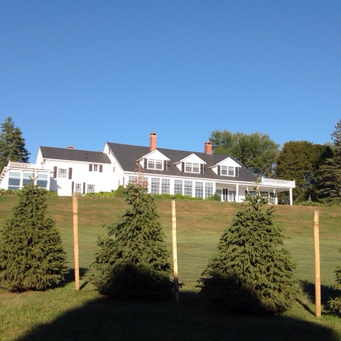
Our buddy Lar, notice the crosses painted on the doors, when I asked he said it was tradition. 

We stopped in Crouse Harbour in order to see the French shore tapestry in Conche and got more than we bargained for.  The people in Crouse and Conche were the friendliest we have met yet.  There were a couple of old fellows who greeted us when we came ashore, they gave us directions.  The interpretive centre and the 217 ft. tapestry about life on the French shore were on of the best museums we have encountered. 
When I walked up to the building I could not imagine how they would get a 217 ft. tapestry in the building but they very creatively have wound it around one room.  An artist dreamed up the concept researched and created it and with grants from the government employed lots of women to sew it.  There was over 20,000 hours put in to making it.  The tapestry depicts the history of the French shore of Nfld. from the beginning until the present.  There are 4 languages on the tapestry, French, English, a Scandanavian language and Gaelic. There are panels on the top and bottom and the main theme in the middle, a person could spend hours noticing all the details. 
We got a ride back to the boat after Barry mentioned my sore ankle to some people we were chatting to.  I saw a Dr. in St. Anthony and he said I had damaged my ligaments and I am supposed to rest my foot for a week.  I am trying very hard not to walk around but it is difficult when that is your only mode of transport and there is so much to see.  Oh well I guess I had better suck it up and stay put if I don't want to walk around in pain. 
  
   The stage (or dock) at Crouse, they used to dry and salt the fish here, back in the day

Once back in Crouse we ran into the old fellows again and one of them invited us in for a cup of tea.  He realized that we had not been back to the boat since we had left in the morning and we ended up with a lovely feed of potatoes and fresh cod!! We got to hear wonderful stories about the old days.  Lar is 84, the road and electricity did not come to the area until the 1960's.  He remembers going out with dog teams, if someone was really sick that was the only way to get them to help.  He said there were 18 men on snowshoes in front of the sled to break the trail and the leader would only be able to walk 25 feet, sinking into the snow up to their thighs before the next man in line would take the lead. The snowshoes they used were a lot smaller than the ones we have now. They were very self sufficient, they had gardens, picked berries, and the goats, sheep and cows ran wild, there were only 3 horses in the area. There was a plane that crashed in the area in 1942, it was being ferried back to England.  He was in school and the teacher would not allow the kids to go to the windows to watch the fellow who parachuted out or the plane which crash landed, but the other two aboard lived.  The other fellow, Kenny, mentioned the same thing, the teacher would not let them watch, that obviously made a big impression on them, planes were a very rare sight!  Kenny, who is 85, has hardly ever left the community. He has been to St. Anthony once when his father died, and it is only an hour and a half away by car or boat. When Kenny got talking fast he was really hard to understand. 
We sailed and motored down the coast in foggy conditions with very light winds.  There was an old whaling  station in Forche harbour that Barry wanted to see. He says it was a mess, it closed in the 1970's. It was a fiord with steep sides and waterfalls running down from the cliffs. The anchorage was dicey so we motored 10 nm further down the coast of Orange Bay. 
The community of Deep Harbour was resettled in 2003. The town was gettin too small to warrant ta teacher, nurse and the weekly boat that came in with supplies, it was noticeable that a number of houses are still in use.  There were two 50 foot fishing boats in the harbour when we arrived and about 7 or 8 skiffs. Summer holidays could be spent here and a house kept available for the fisherman when he was out on the boat. We wondered how far away the families went when they resettled?? We know of one community on the south coast they are trying to resettle and they are offering each family $250,000. 
We are headed to La Scie just east of Cape St. John.  After that we will be in Notre Dame Bay which has a lot of lovely spots  and good harbours to poke around in. The Northern Pennisula will be behind us and the East Coast beckons. 

IMPORTANT SAILING INFO.
We are using " The Cruising Guide of Nfld." published by Members of the Cruising Club of America and so far it has been very helpful.
Ports or Anchorages
 
Fourche Harbour    50*31' N X 56*19' W
Anchored in 13m. of water just off the old whaling station, only a lunch stop.
Very exposed to winds off the ocean
Fiord like spot with high hills and waterfalls running into the bay form the top.
No services. 

Great Harbour Deep    50*22' N X 56*30' W
Anchored in 8m. of water in Sault Cove just north of town. 
Very good holding, good coverage from all winds except SE. 
Winds funnel in this area so take care where you decide to anchor.
No services, town abandoned in 2003, beautiful spot. 


Wednesday, August 12, 2015

Over the top

We lucked out with another great day to visit L'Anse aux Meadows, the site where the Vikings had a settlement over 1,000 years ago. Oh, we learned they should be called Norse, Vikings were only the ones that pillaged and plundered . Along with the informative displays and movie there is a re- creation of a Norse settlement.  The sod structures were fascinating, I had read about them but never seen one, they were supposed to be fairly warm, but they were very dark inside. 

We also went down to the other site that is in the area mainly to view the Viking ship the Snorri, that reenacted Lief Ericson trip here from Greenland. 
The ship was built in Maine, using know Norse building techniques, put on a container ship and sent to 
Greenland.  Then 7 American sailors and I from Newfoundland sailed her for 97 days in the 90's following the route that the Norse took.  They used woollen sails. It was wide open, with no cover available, they must have froze but there was a place they could have built a fire on it.  
We had had a very bad sleep due to a rolly anchorage so we moved a couple of miles to a spot where Jacques Cartier sat out a gale from May 29 to June 6, 1534. The island that protected the spot was named in his honour. We rounded the top of Nfld. the next morning and were greeted by the sight of more icebergs.  This time we were under sail and did a 360 around a good sized berg. I wish there had been another boat there so we could have had pictures with Cat's-Paw IV doing her thing.  It was nice to have it to ourselves though.


We spent two nights in St. Anthony's.  The second because it poured and was very cold and miserable. The boat was dripping wet inside with the humidity, we had the furnace on but that just made the cold hull weep more. Barry finally got wet and cold enough, our gear is old enough now to have lost most of it's ability to repel water, that he went off and bought himself some fisherman's rain gear, yeah. Today dawned bright, warm and sunny and we made tracks down the coast with a gusty west wind.  

IMPORTANT SAILING INFO.
We are using " The Cruising Guide of Nfld." published by Members of the Cruising Club of America and so far it has been very helpful.
Ports or Anchorages
Quirpon Harbour  51*31'.6 N X 55*27'.1 W
Anchored in 8m. very good holding 
Excellent flat achorage with almost 360 protection. 
Jacques Cartier waited out a gale here so it was good enough for us. 
No info. on services. 
St. Anthony Harbour  51*22' N X 55*35' W
Anchored in 8m. just NW of the Grenfell docks, very good holding
Great 360 protection, no swell
Dinghy access at Grenfell docks, the whale watching outfit there was very friendly and welcoming
All services available except no showers, Laundromat at Irving Gas Station, $3.00/load. 
Crouse Harbour  50*54'.3 N X 55*53'.3 W
Anchored in 7m. fair holding, had to anchor twice, put kellet down, no dock. 
Good protection from prevaling SW winds but wind may funnel through high sided cliffs. Open from SE. 
No services, walk 1.5 km to see French shore tapestry, a must see, small store in Conche. 
Fisherman moor boats, watch for mooring floats. 


Saturday, August 08, 2015

Icebergs and Whales

                                                Our first view of Labrador 
We sailed across the Strait of Belle Isle yesterday.  We had a favourable SW wind but we did not get to enjoy the scenery because the entire journey was made in dense fog.  It is a good thing our radar and AIS are in good working order. When we were within 5 miles of Red Bay, Labrador,  Barry saw a contact on the radar, we could not hear anything and figured it might be a fishing boat mucking about out in the Strait. We steered away from it and inched our way into the harbour at Red Bay, completely blind. We set anchor and soon the fog began to lift. We were in a lovely protected bay, the small town laid out in front of us. 
 We were very excited to see a bergy bit floating into the harbour and as we rounded the corner to go take pictures in the dinghy, we saw the bigger berg grounded in the entrance. 
We had sailed right past it without even knowing, then it dawned on us, the mysterious radar contact that we couldn't hear was most likely an iceberg, as well. 
   A 400 year old shaloop, a small boat used to harpoon the whales, found beneath the San Jaun. 

Red Bay was the site of a Basque whaling community in the 1500's.  A woman archaeologist poured over old documents in Spain and discovered that there had been a whaling settlement here.  Discoveries were made in the 1980's of ruins of the pots they used to render the blubber into oil.  There was also an indication in the literature that a whaling ship had gone down in the harbour.  An underwater excavation was undertaken and the San Jaun was discovered. There is a huge wreck,1985, that is still aground and they followed it's path to doom to find the vessel that sank in 1587. Instead of trying to re float the San Juan they just brought up every timber, measured it and took pictures and then returned it to the deep.  There is a scale model of it in the museum with the timbers they recovered done in a different colour than the rest so you can see how much they actually recovered. There were as many as 2,000 men and boys there at one time, now it is a town of 300.
My hand compared to a whale's fluke, and note my elegant boat attire, there is a layer there you cannot see!! 
We woke this morning to a clear day and the thermometer read 10 degrees, yikes!  Luckily I had my new woollen Labrador socks on to keep my feet warm. 

The Labrador flag is green and blue with that plant in it, I imagine it is meant to be Labrador tea, but I am just guessing. As we getting ready to pull anchor Barry said "look" and out in the Strait was another iceberg which somewhat resembled a house.  
We headed out and circled the two icebergs that had appeared. While we were heading towards them, there was a big  splash and there were bergy bits everywhere. We were gazing fascinated at the behemoth and a whale blew in the distance, it's spume hanging in the air so we could spot it.  Can it get any better than this!  As they say, a picture tells a thousand words so I will let them speak for themselves. 
The second one was much smaller and ready to break in two. 

We had set sail to return to Newfoundland when two whales surfaced fairly near us, wow, wow! After they had gone past us and were what we figured a safe distance away they put on a show, breaching and tail flapping. There were whales everywhere, this would be similar to the spectacle we had off of Cape Cod.  I guess those Basque whalers knew a good thing when they saw it!! 
It is really hard to take a good picture of a whale while underway, with all that flapping and blowing going on and the boat heaving and rolling beneath your feet, it is a miracle if you get a good picture, I will save you the torture of looking at my miserable attempts. A description is in order though.  First you hear the exhalation of air as the whale surfaces, and you look around to spot the water molecules hanging in the air. If you are lucky the whale starts to breach, a big black torpedo goes straight up into the air and gradually it falls backwards into the water and there is an almighty splash, the white water cascading everywhere. When you are quite a distance away, you can see the splash and then hear the whap as 15 tons of whale hits the water. Next it might try the tail flap, the tail appears and whack whack whack, the sound races across the water towards you just after you watch it happen and see the water soar up around it, quite the spectacle. Meanwhile Barry is having a fit, I must admit when they are within 20 meters of the boat I am hoping that they don't pick that particular moment to decide to breach, they never have,  so I figure they know we are there and are being careful!! 

As I sit in the cockpit sipping on my rum and coke, cooled with 10,000 year old ice, I wonder does it ever get any better than this.  This day has been one of the highlights in our nine years of cruising. 

IMPORTANT SAILING INFO.
We are using " The Cruising Guide of Nfld." published by Members of the Cruising Club of America and so far it has been very helpful.
Ports or Anchorages
Flower Cove  51*18' N X 56*45' W
Tied to the dock which was under reconstruction, to be finished fall of 2015.
No services on dock at this time.
Groceries, liquor and fuel available 20 min. away on foot. 
Entrance had lots of hazards but was well bouyed with leading lights. 
Red Bay, Labrador  51*44' N X 56*26' W
Anchored in harbour in 8m. between Saddle Island and the mainland. 
Good holding in settled weather. 
No info on services in town. 
Great museum on Basque whaling ashore, well worth the stop. 
Hay Cove, Nfld.  51*36' N X 55*31' W
Anchored at the end of the cove in 4m. Open to the NE, swell comes in from Atlantic. 
Good holding in settled weather. 
Beach landing available with road access to former Viking settlement. 
Spent a very rolly night, moved anchorages the second night.